
Contents
Event Description
Here’s one of Michael’s favorite, challenging, but fairly short hikes… Mt. Zion! It is JUST challenging enough to feel you have had a tough workout, but not as strenuous as hiking to the Mt. Wilson Observatory. It is also only a half-day hike.
*** READ THE DETAILS BEFORE YOU RSVP! ***
This somewhat tough hike is open to ANYONE. However, you must be physically able and fit to participate.
RSVP
- Participation is free. However, please RSVP with the number of people who are going, along with each of their names (in the RSVP Comments section.) This will help the host(s) plan and lead the event. Do NOT flake on this event, or you may be banned from all future ones.
[RSVPs Disabled]
Info
- Date: 12/13/2019
- Start/End: 7:45am – 2pm
- Organizer: Michael Yuen
- Difficulty: 6-8 out of 10, Elevation gain: 2,100′, Distance: approx. 8 miles round trip
- Time: approx. 4-6 hours
- More info: LocalHikes
DID YOU KNOW? Organizers spend a tremendous amount of time and effort planning events — do not re-post without their prior consent
Know Your Abilities!
Disclaimer and Model Release. We want everyone to enjoy their time. However, readers, participants, and their guests should be aware of the POSSIBLE DANGERS involved in any type of activity and event. They may include serious risk of injury or death. By participating, all parties hereby agree to our Terms of Use.
Venue
Location: Chantry Flats, San Gabriel Mountains (Angeles National Forest)
- Nearby: Arcadia, CA / Intersection: Santa Anita Ave, 210 Freeway
- GPS Coordinates: Google Maps / 34.195442, -118.022472/ 34°11’43.6″N 118°01’20.9″W
Directions (Source)
- 210 Freeway (East of Pasadena). Exit Santa Anita Avenue and go North (toward the mountains). Go to the end of the road and park in one of the parking lots at Chantry Flat
- There is Adams Pack Station just above the last parking lot where you can buy additional supplies or possibly pay for private parking
- The drive from Arcadia / 210 Freeway is about 30 minutes
- Due to the area being VERY popular, parking fills up by 7:30am on weekends, forcing parking along the side of the road. If you park along the road, be sure your car is completely behind the line, or you will be ticketed or towed. You MAY be able to find overflow parking at the nearby, private Adams Pack Station. However, be aware that they tend to leave your car keys on one of the tires, making it possible for someone to swipe your vehicle
- Parking is free, but a Forest Service Adventure Pass is required, which are sold at REI, Walmart, sporting good stores, and also at the Chantry Flats Adams Pack Station. Do not punch in the Adventure Pass until the cars are consolidated. Often times, we can consolidate multiple cars into one, saving 1 Adventure Pass or more (that can be used for another time)
Meeting
- We start hiking by 8:15am.
- If you arrive late, it’ll be VERY HARD to find parking. This is a VERY popular place, and parking fills up by 7:30am. Meet us at the trailhead if you want to sleep in/skip breakfast/car consolidation.
- 7:15 am: consolidate cars and re-park at REI @ 214 North Santa Anita Ave, Arcadia
- If you need to pick up breakfast/lunch, you can do so at nearby McDonald’s @ 143 E Foothill Blvd, Arcadia, CA 91006, but do not miss the meeting time at REI, or the organizers will leave without you
- 7:45 am: meet at the Chantry Flats Parking Lot/Trail head (Map/GPS Coordinates: 34.195442, -118.022472/ 34°11’43.6″N 118°01’20.9″W)
- Note: If you have to park on the road, mind the “No Parking” spots and signs, and always park completely behind the white line to avoid getting ticketed
Don’t be late! Parking fills up by 7:30 am!
Cost
- You’ll need a $5 Adventure Day Pass for each car (avail at any sporting goods store, such as Walmart, Sportchalet, Big5, REI.) DO NOT scratch off the Pass! We’ll determine at car consolidation how many we’ll need to use. Carpooling is encouraged. Bring cash with you in case there’s no spot available, and you find a spot at the nearby, private parking lot ($10). This may fill up FAST
Route
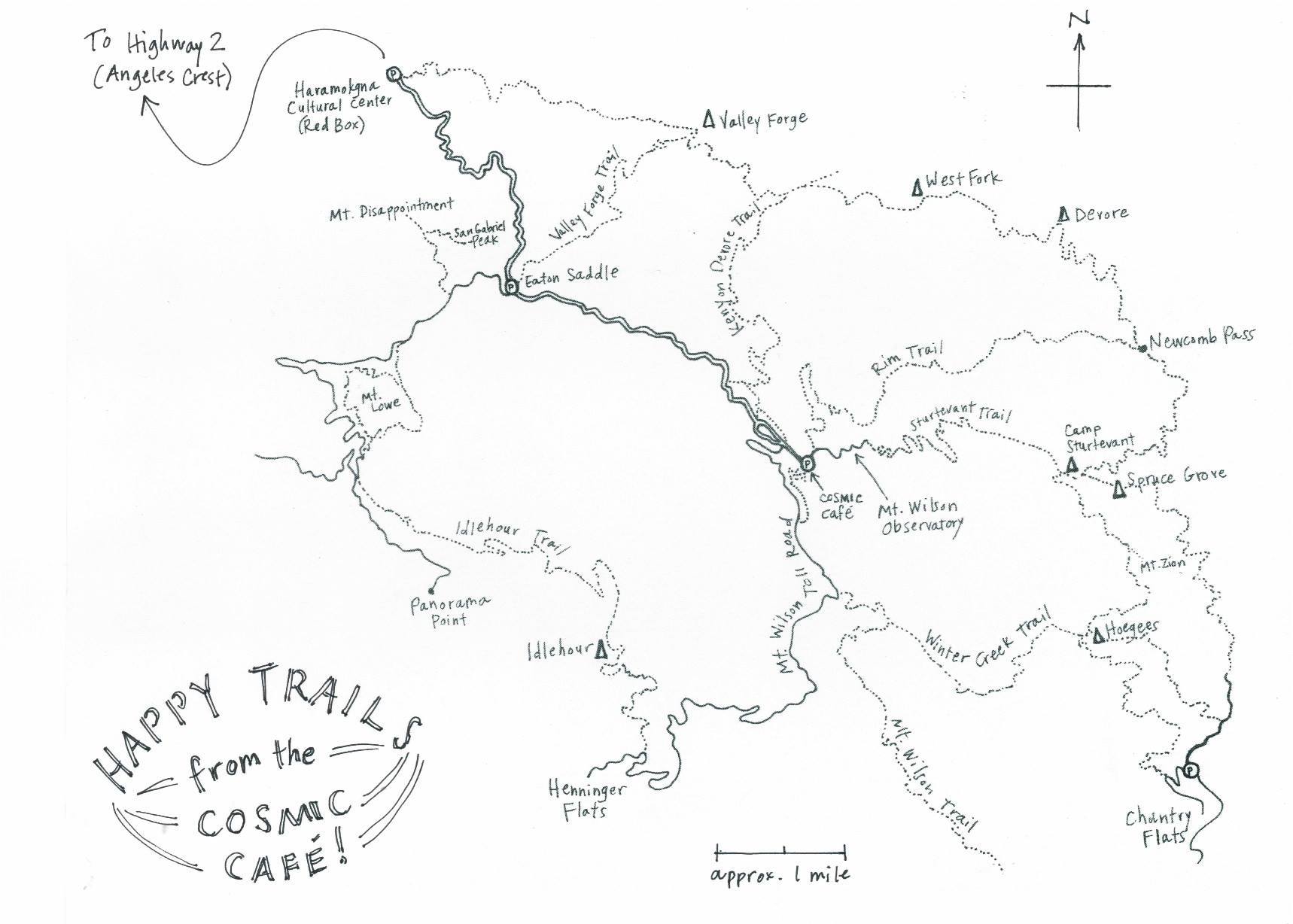
Trail map courtesy of Cosmic Cafe
- This route will be shaded for 3/4 of the hike with the last 1/4 fully exposed to the sun
- Start: Chantry Flats > top of Sturtevant Falls > Spruce Grove Campground > Sturtevant Camp > Mt. Zion
- Return: Mt. Zion > Hoegree Campground > Winter Creek Trail > Chantry Flats
- There is NO cellphone reception along most of the route
- Michael Yuen had completed this route solo in about 4 hours. For reference, here were the highlights:
- Started late at 10:30am, and parking was only available 0.5 – 1 mi away
- 30 mins – Parking space to Chantry parking lot
- 30 mins – Chantry parking lot to top of Sturtevant Falls. He noticed it’s the same amount of time to reach Sturtevant Falls. Visiting the waterfall and then going to the top of it would have added approximately 15-30 mins
- 15 mins – Gabrielano Trail junction (left route goes back to Chantry, right to Wilson Observatory)
- 15 mins – Picnic table with outhouse, 15 mins – Spruce Grove Campground
- 5 mins – Dam crossing to trail left, 4 mins – Zion trail junction (it is 3.25 mi to Mt. Wilson Observatory from here)
- 25 mins – Mt. Zion/Hoegee Campground trail split
- 3 mins – Mt. Zion summit, 3 mins back to the split. 30 mins – Hoegee Campground
- 5 mins – Winter Creek Trail junction (left route goes back to Chantry, right to Wilson Observatory)
- 30 mins – Chantry Flats parking was clearly visible from the trail
- 10 mins – Long, metal pipe on the left of the trail. 3 mins – Asphalt road, and 2 mins later – Chantry parking lot
What To Bring
- Snacks/Food for lunch
- Plenty of water (plus 1 or 2 extra bottles in case your hydration pack unexpectedly runs out)
- Flashlight
- Warm clothing, including a windbreaker/rain jacket & fleece jacket.
- Layer your clothes so you can easily adjust to temperature changes
- Gloves & Beanie – it will probably be cold at this time of year (as cold as 40F)
- Comfortable hiking shoes. Tennis shoes may NOT be okay, depending on wetness of trail
- Sandals to change into once we return to car
- Hiking poles
- Clip your toenails! (Ill-fitting shoes can cause your toes to hurt, potentially resulting in a black toe)
- Some salt for possible cramping
- Some individuals may bring a Jetboil to boil water with. This would be great for hot chocolate, instant noodles, etc.
Carpool
- Please be courteous and contribute to drivers’ fuel costs. Post a comment to make carpool arrangements with others.
- Carpool/Caravan with Michael:
- Meet across Carl’s Jr. parking lot by 6:00am @ 450 The City Drive South, Orange, CA 92868
- Leave by 6:15am. Carpool in Michael’s car is first come first serve, and seats 5-7
- Breakfast/Lunch can be picked up, upon request, at McDonald’s @ 143 E Foothill Blvd, Arcadia, CA 91006
- Head over to REI for a quick check for other participants before driving to the trail head
Credits:
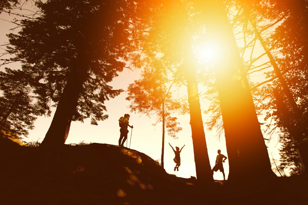
– Featured Image by ChiroNiku via Unsplash